You must specify the area of the proposed action under the EPBC Act. You can define the area by drawing a polygon on the interactive map or uploading a spatial file that you have created. Here's how you do it:
Drawing on the map
Step 1 – Navigating with the map
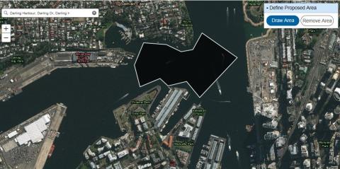
You can search for a specific location using the search bar.
- Enter an address, city, postcode or area in the search bar provided in the map. This will generate a list of matching locations.
- When you select a location from the list the map will zoom to the selected location.
You can click the plus or minus buttons in the top left corner to zoom in and out of the map.
Step 2 - Draw the proposed area(s)
- Click on Draw Area.
- Begin drawing your area by a single left click on the map, move the cursor to the next point and left click. Draw the area in either a clockwise or anticlockwise direction with no cross over or intersecting lines. To finish drawing the area double left click, don't try to close the polygon yourself as this can cause intersecting lines.
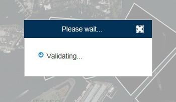
- When you complete the area, the map will validate the shape you have drawn. Please wait for this validation to be completed before adding any additional shapes.
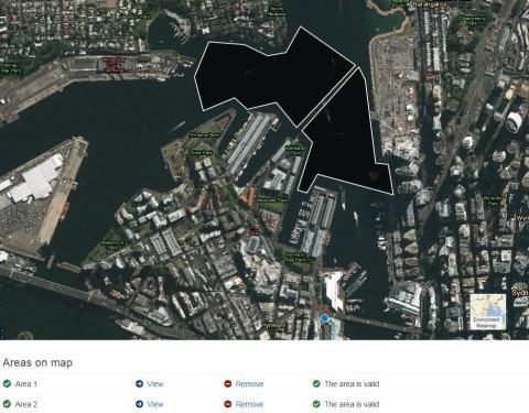
You can draw multiple areas by repeating Step 2. There is a limit of 50 areas.
The table below the map shows each area and gives you the option to view the area or remove it from the list.
Uploading a spatial file
To define the action area using a spatial file you must have either add:
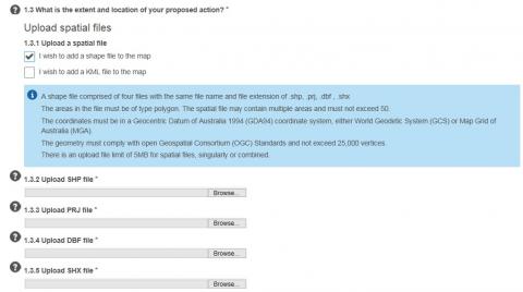
- A shapefile comprised of four individual files with the file extension
- .shp
- .prj
- .dbf
- .shx
OR
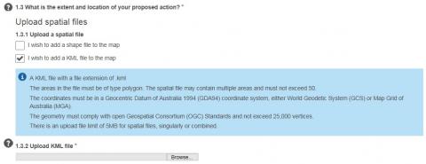
- A KML file with a file extension of .kml
When uploading a spatial file, the shape must be a polygon; lines and points are not allowed. The spatial file may contain multiple shapes and must not exceed 50.
The coordinates must be in a Geocentric Datum of Australia 1994 (GDA94) coordinate system, either World Geodetic System (GCS) or Map Grid of Australia (MGA).
The geometry must comply with open Geospatial Consortium (OGC) Standards and not exceed 25,000 vertices.
There is an upload file limit of 5MB for spatial files, singularly or combined.
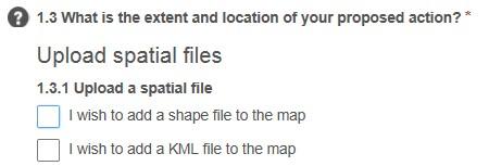
Step 1: Select a spatial file type
To upload the relevant spatial file, select one of the following options in the form:
Step 2: Upload the spatial files
- If you select 'I wish to add a shape file to the map', the following fields will display:
If you select 'I wish to add a KML file to the map', the following fields will display: - When you have uploaded the relevant spatial files for the proposal area, the map will validate the shape. Please wait for this validation to be completed before adding any additional shapes.
- Each area contained in the spatial files will be drawn on map and added to table below the map.
You can repeat the steps to add more areas. There is an upload file limit of 5MB for spatial files, singularly or combined.
The table below the map shows each area and gives you the option to view the area or remove it from the list.
If the spatial file contains multiple parts then each part is drawn on the map and is displayed in the table below the map. There is a limit of 50 areas.
Removing areas
You can remove an area by selecting shape on the map and using the Remove Area option on the map, or by selecting the option next to the relevant area in the table below the map.
Do you need further assistance?
If you require further assistance, please submit an Ask us anything enquiry.
Related articles
Why is the area invalid?


