You must specify the area of the proposed action under the EPBC Act. The interactive map provided in the EPBC Act referral form allows applicants to plot the coordinates of the proposed action in the form of a polygon. Here's how you do it:
Search for a location
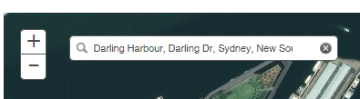
1. Enter an address, city or area in the search bar provided in the map.
2. Once you have selected a location, the map will zoom to the selected location:
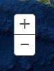
Zoom in/zoom out:
1. Click on ‘+’ to zoom in.
2. Click on ‘-‘ to zoom out.
Move Map:
1. Click and drag on the map to move the map image.
Tip: double click on a specific location to zoom in to the location.
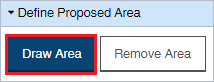
Draw and label the proposed action:
1. Click on Draw Area in the draw toolbox.
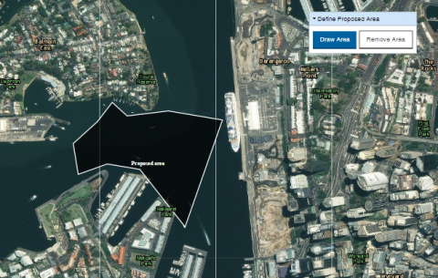
2. Begin drawing your polygon (each click creates a coordinate point).
3. Double click on the map to finalise the polygon drawing. (Note, you must not draw intersecting lines in your polygon drawing. You may create more than one individual polygon drawings as long as it does not exceed 150 points).
4. A text box will appear, label your polygon drawing.
5. Click on OK.

The polygon shape will appear on the map. You can enter multiple polygons if necessary.
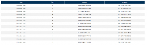
The coordinates table below the map will show the coordinates of each point within the proposed area(s).
Remove Polygon:
1. Select the proposed area. The area will be highlighted red.
2. Click on Remove in the draw toolbox.

The polygon drawing has been removed from the map and coordinates table.
Do you need further assistance?
If you require further assistance, please submit an Ask us anything enquiry.